California is no stranger to big swings between wet and dry weather. The “atmospheric river” storms that have battered the state this winter are part of a system that has long interrupted periods of drought with huge bursts of rain—indeed, they provide somewhere between 30 and 50 percent of all precipitation on the West Coast.
The parade of storms that has struck California in recent months has dropped more than 30 trillion gallons of water on the state, refilling reservoirs that had sat empty for years and burying mountain towns in snow.
But climate change is making these storms much wetter and more intense, ratcheting up the risk of potential flooding in California and other states along the West Coast. That’s not only because the air over the Pacific will hold more moisture as sea temperatures rise, leading to giant rain and snow volumes, but also because warming temperatures on land will cause more precipitation to fall as rain in the future, which will lead to more dangerous floods.
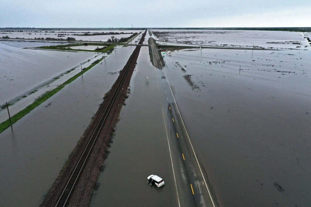
The family of storms that descended on the state this week only underscored this danger, shattering snow records and overtopping levees across the state.
“There’s a cascading chain of impacts,” said Tom Corringham, a researcher at the Scripps Institution of Oceanography at UC San Diego. “As you push the rivers harder, as you push the flood protection system harder and harder, you get sort of exponentially increasing impacts. You flood the whole floodplain, or a levee breaks, and that’s where you get the really catastrophic events.”
An “atmospheric river” is a long, narrow ribbon of moisture that carries water vapor from the tropics to land at higher latitudes. One of the most well known examples is the “Pineapple Express,” which streams eastward from Hawaii across the Pacific Ocean and makes landfall on the West Coast. The term atmospheric river originated back in the 1990s, and it caught on because of the high volume of water that these ribbons can contain: A single one can move more than twice as much water through the sky as flows out of the mouth of the Amazon, the world’s largest river by volume.
As sea and air temperatures in the Pacific Ocean rise, the storms hitting the West Coast now retain more moisture, leading to longer and more intense bouts of rain. At the same time, precipitation from low- and medium-intensity storms has started to taper off, leaving California to swing on a pendulum between extreme drought and extreme rain. Research suggests that with further warming, atmospheric river events will account for an ever larger share of California’s total water budget, dumping water faster than the state can absorb it.
“Across the globe, some places are gonna get wetter, and some places are gonna get drier, and for California, it looks like we’re gonna get both,” said Corringham. “There’ll be longer periods of drought, and then when the rains come, those events are going to be more intense. For water management, that’s not what you want.”
When an atmospheric river touches down in North America, it releases all its moisture. Depending on where you are along the West Coast, you encounter that moisture as either rain or snow: Lower-altitude areas like the Central Valley experience heavy rains, while mountainous areas like the Sierra Nevada see massive mounds of snow. When it comes to controlling water and avoiding floods, this balance is crucial. Snow piles up, creating a steady source of freshwater as it melts during warmer, drier months; extreme rain, meanwhile, rushes downstream all at once.
Climate change is upsetting this balance. The warmer it gets in California, the more precipitation arrives as rain rather than snow, which will put much more pressure on the state’s rivers and reservoirs. The state’s reservoir systems are designed to absorb gradual snowmelt, but they can’t handle a sudden influx of rushing water.
Corringham’s research shows that because a slight increase in flooding can cause rivers to overtop levees and spill out into floodplains, the risk of flooding increases exponentially even with a moderate increase in the wetness of an atmospheric river. As a result, it won’t take much planetary warming to lead to widespread flood devastation—the results may be visible over the next few decades, or even earlier.
We’ve already seen what big bursts of rain can do to the state’s fragile water control system. In early 2017, when an atmospheric river storm eased the state’s last big drought, water levels at the state-managed Lake Oroville reservoir reached unprecedented heights. As rain kept falling, the reservoir’s spillway began to collapse, forcing the state to evacuate more than 180,000 people from the river basin downstream. A subsequent investigation found that federal regulators had deferred major upgrades on the spillway structure.
Just two weeks ago, during a torrential atmospheric river storm, a decades-old levee burst along the Pajaro River near Santa Cruz, inundating the entire community. Officials in the town said it may be months before homes in the area are habitable.
Even if the state makes it through the present round of storms without a catastrophic flood, it won’t be out of the woods yet. That’s because of the monumental snowpack in the Sierra Nevada range. As temperatures shoot up over the coming months, much of that snow will thaw out and flow downstream, creating what one expert has called a “stress test” for the Central Valley’s flood management system.
“If temperatures are warmer, and warm at a faster rate, that can cause the snowpack to melt faster than normal, and it might be harder to anticipate and harder to control,” said Allison Michaelis, an associate professor at Northern Illinois University.
Source : Wired

